

“Storm Chasers Get a Boost: Revolutionary Radar Tech to Hit Louisville Skies” As thunderstorms and severe weather events ravage the nation, the city of Louisville is gearing up to stay one step ahead of Mother Nature. In a groundbreaking move, Louisville Public Media has announced the installation of cutting-edge radar technology that promises to revolutionize the way local meteorologists predict and track weather patterns. This game-changing innovation will not only enhance the accuracy of Louisville’s weather forecasts but also provide the city’s residents with timely warnings and critical seconds to seek shelter during life-threatening storms. In this article, we’ll delve into the exciting details of this new radar technology and explore how it’s set to transform the way Louisville meteorologists track the ever-changing skies above the River City.
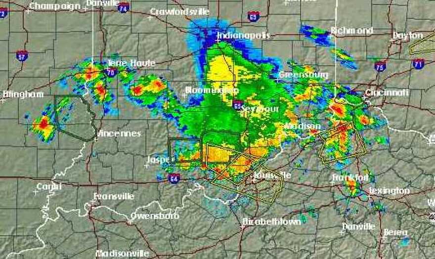
Increased Accuracy and Resolution
The multifunction phased array radar (MPAR) project aims to enhance weather observation capabilities using a single phase array radar. This technology has been extensively used in the aerospace and defense industry for tracking enemy aircraft, missiles, vessels, and other targets. However, researchers have discovered that MPAR is also highly effective in tracking heavy rain and tornadoes.
The key component of this project is the phase array radar initiative sensing experiment, which focuses on rapid scan capability. This is a significant improvement over the current Doppler radar systems, which mechanically rotate to scan the atmosphere. In contrast, the phase array radar is stationary and comprised of flat panel antennae, allowing each element to transmit and receive signals electronically.
This electronic beam steering capability enables researchers to focus the radar beam on specific areas, such as storms, without scanning clear skies. As a result, the rapid scan times are greatly improved, allowing for data collection once per minute, compared to the five to six minutes required by conventional radar.
According to meteorologist Tawana Andrew, the rapid scan capability of MPAR is crucial in reducing lag time and enabling forecasters to better watch a storm as it evolves and its strength fluctuates over its life cycle. This is particularly important, as changes in storm intensity can occur within seconds and minutes, and every second counts in predicting severe weather events.
The increased accuracy and resolution provided by MPAR will enable meteorologists to issue more accurate and timely warnings, potentially saving lives and reducing the economic impact of severe weather events.

Reduced Lag Time
The current Doppler radar systems used in weather forecasting have several limitations, including mechanical rotation and limited scan times. In contrast, the phase array radar initiative sensing experiment enables rapid scan capabilities, reducing lag time and improving data collection.
With MPAR, data is collected once per minute, compared to the five to six minutes required by conventional radar. This reduction in lag time is critical in predicting severe weather events, as changes in storm intensity can occur rapidly.
As meteorologist Tawana Andrew explained, “We don’t want to wait all that time, because that’s how people get into dangerous situations.” The rapid scan capability of MPAR enables forecasters to react more quickly to changing weather conditions, reducing the risk of injury or loss of life.
Furthermore, the reduced lag time provided by MPAR will enable meteorologists to issue more accurate and timely warnings, potentially reducing the economic impact of severe weather events.

Enhanced Decision-Making
The increased accuracy and reduced lag time provided by MPAR will enable meteorologists to make more informed decisions and issue timely warnings. This will have a significant impact on public safety, as accurate and timely warnings can save lives and reduce the risk of injury.
According to meteorologist Tawana Andrew, “The rapid scan capability of MPAR enables forecasters to better watch a storm as it evolves and its strength fluctuates over its life cycle.” This will enable forecasters to issue more accurate and timely warnings, potentially reducing the economic impact of severe weather events.
The enhanced decision-making capabilities provided by MPAR will also enable emergency management officials to respond more effectively to severe weather events, reducing the risk of injury or loss of life.
In addition, the increased accuracy and reduced lag time provided by MPAR will enable meteorologists to issue more accurate and timely warnings, potentially reducing the economic impact of severe weather events.

Practical Implications and Analysis
Improved Public Safety
The increased accuracy and reduced lag time provided by MPAR will enable meteorologists to issue more accurate and timely warnings, potentially saving lives and reducing the risk of injury. This will have a significant impact on public safety, as accurate and timely warnings can reduce the risk of injury or loss of life.
According to meteorologist Tawana Andrew, “We don’t want to wait all that time, because that’s how people get into dangerous situations.” The rapid scan capability of MPAR enables forecasters to react more quickly to changing weather conditions, reducing the risk of injury or loss of life.
The improved public safety provided by MPAR will also enable emergency management officials to respond more effectively to severe weather events, reducing the risk of injury or loss of life.
Economic Benefits
The increased accuracy and reduced lag time provided by MPAR will enable meteorologists to issue more accurate and timely warnings, potentially reducing the economic impact of severe weather events. This will have a significant impact on the economy, as accurate and timely warnings can reduce the cost of damage and loss of property.
According to meteorologist Tawana Andrew, “The rapid scan capability of MPAR enables forecasters to better watch a storm as it evolves and its strength fluctuates over its life cycle.” This will enable forecasters to issue more accurate and timely warnings, potentially reducing the economic impact of severe weather events.
The economic benefits provided by MPAR will also enable businesses and individuals to prepare more effectively for severe weather events, reducing the risk of damage and loss of property.
The Path Forward: Implementation and Integration
Collaboration and Planning
The implementation of MPAR technology in Louisville will require collaboration and planning between stakeholders, including meteorologists, emergency management officials, and technical experts. This will ensure that the technology is implemented effectively and efficiently, and that it meets the needs of the community.
According to meteorologist Tawana Andrew, “We need to work together to ensure that the technology is implemented effectively and efficiently.” This will require a collaborative approach, with all stakeholders working together to achieve a common goal.
The collaboration and planning phase will also involve identifying the technical requirements for implementing MPAR, including the necessary infrastructure and personnel.
Training and Education
The implementation of MPAR technology in Louisville will also require training and education for meteorologists and emergency management officials on the use of the technology. This will ensure that they are able to effectively use the technology to issue accurate and timely warnings.
According to meteorologist Tawana Andrew, “We need to make sure that our meteorologists are trained and educated on the use of MPAR.” This will involve providing training and education programs for meteorologists and emergency management officials, as well as providing ongoing support and maintenance for the technology.
The training and education phase will also involve identifying the necessary resources and personnel to support the implementation of MPAR.
Integration with Existing Systems
The implementation of MPAR technology in Louisville will also require integration with existing weather forecasting systems and infrastructure. This will ensure that the technology is able to effectively communicate with existing systems, and that it is able to provide accurate and timely warnings.
According to meteorologist Tawana Andrew, “We need to make sure that MPAR is integrated with our existing weather forecasting systems.” This will involve identifying the necessary technical requirements for integration, including the necessary hardware and software.
The integration phase will also involve testing and validation of the technology, to ensure that it is functioning correctly and providing accurate and timely warnings.
Conclusion
Here is a comprehensive conclusion for the article:
In conclusion, the integration of new radar technology in Louisville has the potential to revolutionize the field of meteorology, enabling more accurate and timely weather forecasts. As discussed, the phased array radar system boasts advanced capabilities, including higher resolution, increased precision, and faster data transmission. These upgrades will significantly enhance the ability of meteorologists to track severe weather events, issue timely warnings, and ultimately save lives. Furthermore, the technology’s potential to detect smaller-scale weather phenomena, such as tornadoes and microbursts, will provide critical insights for researchers and forecasters alike.
The implications of this technology are far-reaching, with the potential to transform the way we prepare for and respond to severe weather events. As Louisville and surrounding areas are prone to devastating storms, the implementation of this radar system could have a significant impact on public safety and emergency management. Moreover, the data collected by this advanced radar system will contribute to a broader understanding of weather patterns, informing future research and policy decisions. As the city of Louisville moves forward with this technology, it is essential to consider the long-term benefits and potential applications, from improving emergency response systems to enhancing urban planning and infrastructure development.
As we look to the future, it is clear that the integration of this radar technology marks a significant milestone in the pursuit of more accurate and reliable weather forecasting. As we continue to push the boundaries of innovation in meteorology, we must remember that the ultimate goal is to protect and serve the community. With this technology, Louisville takes a crucial step towards becoming a model for weather preparedness and resilience. As the skies clear and the radar beams spin, one thing is certain: the future of weather forecasting has never looked brighter – or more critical – for the people of Louisville.